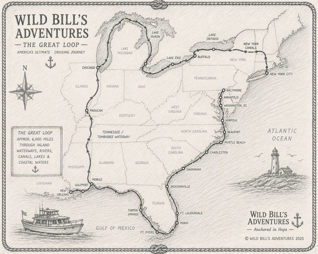
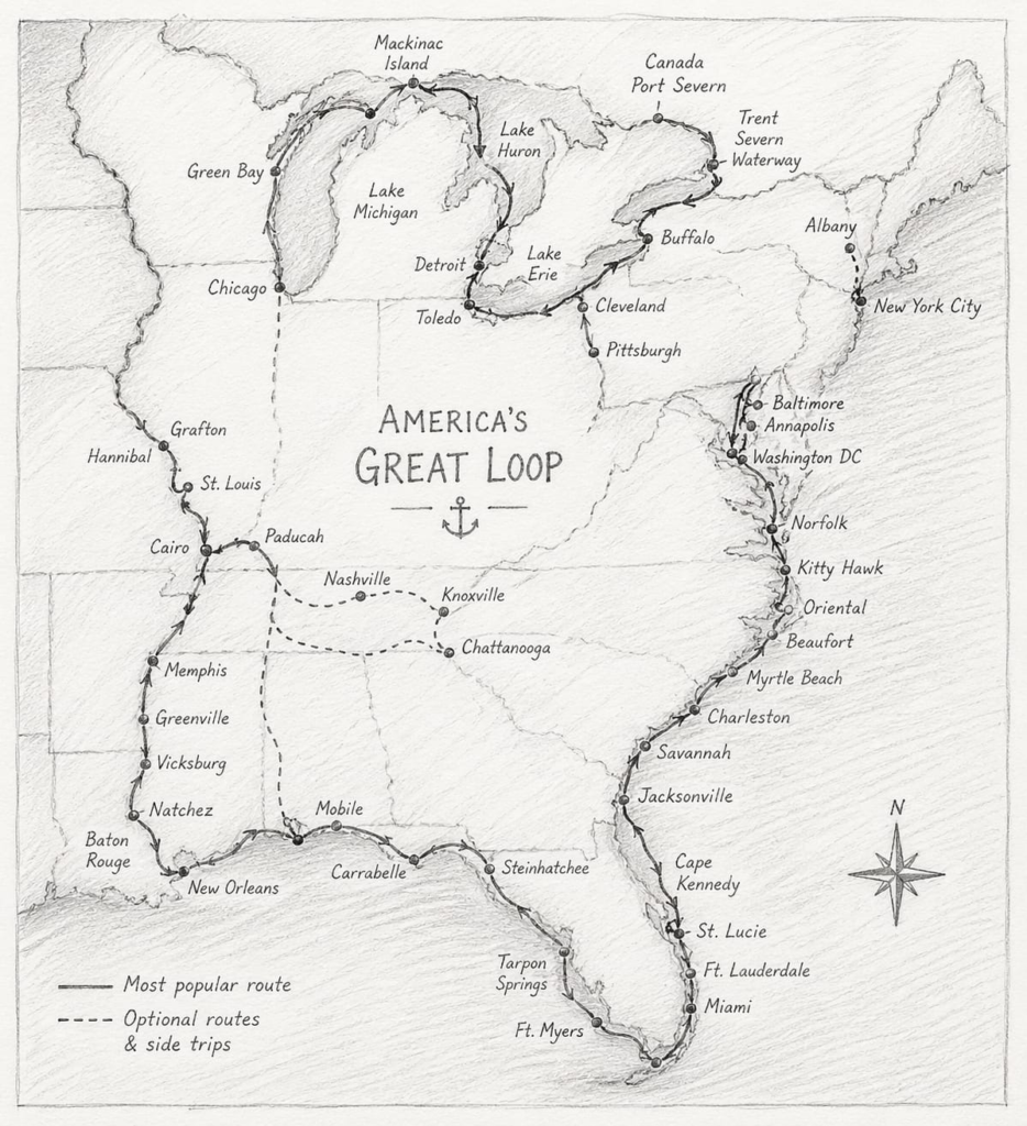
A continuous boating route navigating Eastern U.S. and parts of Canada, encompassing stretches of the Atlantic and Gulf Intracoastal Waterways (ICWs), the Great Lakes, the Erie Canal, and major inland rivers like the Mississippi and Tennessee–Tombigbee systems.
Most Loopers complete approximately 6,000 miles, though depending on route choices and side trips, the journey can range between 5,250 to well over 6,000 miles.
Although there’s no official starting point, many begin in Chicago and proceed counter‑clockwise to take advantage of favorable currents and avoid northern winter ice and southern hurricane season.
Standard progression:
Route timing is crucial:
Summer: Great Lakes & Canadian waterways
Fall: Inland rivers and southern descent
Winter: Florida and Gulf region
Spring: Ascend the Atlantic Coast
Most Loopers take 6 months to a year, but timelines can vary widely—from a few months to several years—depending on pace, stops, and side adventures.
Draft (depth below waterline): A draft over 5 ft is discouraged—some areas (e.g., Gulf ICW and Ontario canals) require drafts under 5 ft; Trent–Severn Waterway requires 6 ft clearance and may require waivers; Rideau Canal is only 5 ft.
Air draft (height clearance): Most restrictive is a fixed bridge on the Illinois River at 19.6 ft. Some Erie Canal bridges may be as low as 15–15.5 ft; Oswego Canal allows up to 21 ft.
Fuel range: Longest stretch without refueling is ~200 miles between Kimmswick, MO and Paducah, KY. Extra fuel may be needed.
Locks and canal widths: The narrowest lock is the Port Severn Lock on the Trent–Severn Waterway at 23 ft width—could be restrictive for very wide vessels.
There are several alternate paths and optional side routes:
Instead of going all the way through the Erie Canal, you can divert through the Oswego Canal toward Ontario and follow the Trent–Severn route.
Adirondack side-loop to Montreal via the Champlain Canal
Optional Lake Superior via the Soo Locks
Coastal east route up through Nova Scotia, via the St. Lawrence Seaway (longer, more open water).
These variations enrich the trip but require thoughtful vessel and seasonal planning.
